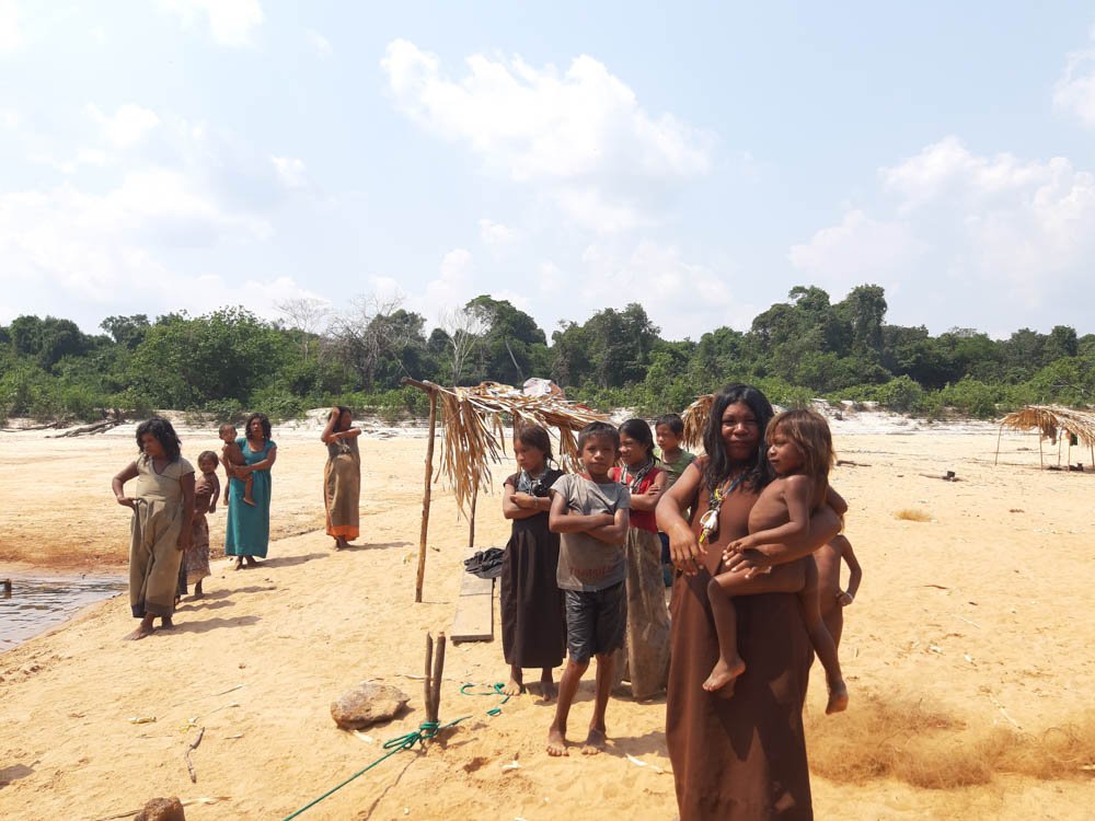
In the Purus and Madeira rivers’ interfluve – in the states of Amazonas and Rondônia – there are some critical areas of expanding deforestation. One of its main drivers is the recovery and reconstruction of federal highway BR-319, as well as the construction of other state roads that are already in the planning stages (AM-366, AM-364, AM-360, and AM-356), aggravating risks to these areas from the increased flow of people into the region. Along the BR-319 highway, the forest is already under the greatest human pressure in its history.
In 2020, 9,849 hectares were deforested in the 42 conservation units monitored by OBR-319. The Jaci-Paraná Extractive Reserve (Resex) topped the ranking for deforestation in almost every month of the year, with the exception of February and March. With 7,203 hectares of deforested areas, this conservation unit accounted for 73% of total deforestation in the 42 conservation units in 2020. That same year, 1,810 hectares were cut down in the 69 Indigenous Lands monitored by OBR-319. The Karipuna Indigenous Land was deforested the most (526 ha), representing 29% of total deforestation in the monitored indigenous lands. It also led the ranking for the longest time: for six months in 2020.[1]
Notes
Observatório BR-319. Informativo No 15, January 2021.
The reconstruction and pavement of Highway BR-319 will have harmful consequences for the region’s indigenous peoples and ecological diversity. That is why the highway from Manaus, in the middle of the Amazon region, to Porto Velho, located in the extreme south of the forest, is considered one of the most critical factors for the environment, since it could connect the arc of deforestation to the Central Amazon region, bringing with it the agents and investments that have already deforested an extremely sociobiodiverse and well-conserved region.
The “arc of deforestation” is the name given to the area along the southern and eastern sides of the Brazilian Amazon. In addition to deforestation, it has the most land conflicts and murders of environmental activists, peasants, and traditional peoples. Hence, the outlook for rebuilding and repaving the highway heightens pressures on a vast area of rainforest in the western part of the state of Amazonas, due to the influx of more people into the region. As we already know, the opening of side roads and population growth through migration are responsible for deforestation, timber extraction, forest fires, land grabbing, and malaria outbreaks, among other impacts. Despite the widely held developmentalist notion that BR-319 can bring economic prosperity to municipalities along the route (by shortening distances and transport costs), it is crucial to recognize that if effective measures are not taken to increase governance and strengthen environmental management capacity, the road is likely to trigger settlements and the exploitation of natural resources, with a dramatic upsurge in deforestation in the region.
Highway BR-319 increases pressure on indigenous lands and federal conservation units in the road’s area of influence, with a number of environmental impacts, according to the representative of the Chico Mendes Institute for Biodiversity Conservation (ICMBio), Victor Bruno (manager of the Lago do Capanã Grande Resex): “There has been an increase in environmental violations such as invasions and subdivisions along the road by migrants from other states, ever since 2015. In this context, the increasing sales of land inside federally owned territory along this road are all aimed at creating irregular subdivisions.”[2] This is a phenomenon that often comes on the heels of such projects being announced: more land grabbing and real estate speculation near the roadways, with expectations for rising land prices. In other words, even before the work begins, indigenous peoples and traditional communities in the region are already feeling the pressure on their territories and the forest.
At a public hearing held February 20, 2018 in the Manicoré (Amazonas) City Council chambers to discuss the re-opening of the BR-319 and AM-364 highways, the ICMBio agent also warned that “the road width today is too narrow for the traffic of people and cargo (merchandise), and there may be further demands to open other areas, causing deforestation and sediments filling the igarapé streams that feed the Purus and Madeira rivers.” He also explained that the highway has an intense circulation of wild animals.[3]
The omission of public authorities regarding demands for land-use planning and law enforcement in the area of influence of the BR-319 highway has allowed the occupation of these areas for speculation, illegal deforestation, and agrarian conflicts. According to indigenous Chief Waldemiro Farias da Silva Apurinã, an illegal side road is being built by ranchers to connect Tapauá, on the Purus River, to the BR-319, using the municipal government’s construction equipment.[4] That road is a threat to the Apurinã do Igarapé São João and the Apurinã do Igarapé Tauamirim Indigenous Lands, as well as to the Nascentes do Lago Jari National Park. As researcher Philip Fearnside reports: “The chief declared that the invaders are not indigenous and that indigenous people are very afraid to go into these areas, because the felling of trees is massive even inside the Indigenous Land, putting all the villages at risk. According to the chief, indigenous people are being threatened”.[5]
Notes
Philip M. Fearnside. “Região Trans-Purus, a última floresta intacta: 2 – A ameaça do Ramal de Tapauá”. Amazônia Real, August 31, 2020
Vanildo Pereira da Silva Filho is a lawyer and works as an indigenist missionary with the Indigenist Missionary Council (CIMI) and the Amazonian Service of Action, Reflection and Socio-Environmental Education (SARES).
Paulo Tadeu Barausse is the coordinator of the Amazonian Service of Action, Reflection and Socio-Environmental Education (SARES) and a member of the REPAM North AM/RR Committee.


